


How can a pedestrian network be shaped in a city with challenging terrain?
Walking is an integral part of every journey we make. Whether moving from a parking lot to our workplace or from school to a public transport stop, a portion of that journey is always made on foot. The importance of walking has gained significant recognition in modern sustainable urban mobility planning, placing pedestrians at the core of urban service design.
However, pedestrians remain a group of road users who often face difficulties in the urban environment. When we also consider that many vulnerable users (such as the elderly, children, people carrying loads, and individuals with disabilities) move as pedestrians, the need to support them through appropriate and high-quality infrastructure—like Urban Accessibility Networks—becomes even more pressing.
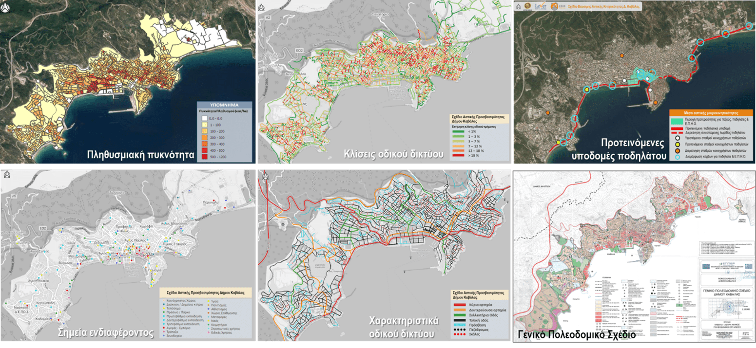
In 2023, the Municipality of Kavala undertook the development of an Urban Accessibility Plan aimed at improving pedestrian mobility within the wider urban center and the larger settlements of the municipality. In such a demanding city—due to its steep terrain, unstructured urban development, and other factors—planning for pedestrians presents a real challenge.
The company “Lever – Development Consultants S.A.”, a member of the “Samaras & Associates Group”, supported the Municipality of Kavala in drafting the Urban Accessibility Plan by developing a specialized methodology tailored to the city’s unique challenges. Taking into account the locations of points of interest, the characteristics of the road network, inclines, and the commercial/friendliness value of each street segment, Lever was able to identify pedestrian flows through specific network analysis procedures.
The routes derived from this network analysis were then thoroughly examined through on-site field inspections to determine the necessary actions required for their improvement.